Terrain shows what a mine looks like. Fleet data shows what the mine is doing. A mining digital twin that combines both gives a more complete view of operations than either source alone. This article explains what Fleet Management System (FMS) data contains and how it is used in a digital twin.
What a Fleet Management System Does
A Fleet Management System is software used in mining to monitor and coordinate mobile equipment. Depending on the product and configuration, an FMS can record:
- the GPS position of each unit
- operating status, such as working, standby, delay or breakdown
- loading and dumping events
- haul cycle times
- payload, when connected to on-board weighing systems
- operator log-in and shift information
Many FMS products also include dispatch functions that assign trucks to loading units and dump points.
FMS data is collected by hardware installed on each unit, typically a GPS receiver and an on-board computer, and transmitted to a central server over the site’s wireless network. The quality of this data depends on GPS accuracy, network coverage and correct operator input for statuses and delays.
Why Combine FMS Data With a Digital Twin
FMS software usually presents data in tables, charts and 2D maps. These are effective for many tasks, but they show equipment separately from the current shape of the terrain.
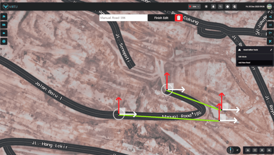
In a digital twin, FMS data is placed on top of a 3D terrain model. This allows users to see equipment positions in relation to benches, ramps, roads, dumps and stockpiles. It also makes it easier to relate delays or slow movement to specific locations on site.
Virtu’s Petrosea Project
Virtu’s Smart Digital Twin Mining project for Petrosea combined a drone LiDAR map with live data from Petrosea’s Fleet Management System. According to Virtu’s project page, users can view each vehicle’s location, route and operating status, with the terrain and fleet data merged into a single view of the operation. The system was delivered on web, mobile and mixed reality platforms.
Information Users Can See
When FMS data is integrated into a digital twin, typical views include:
- Live positions. Each unit appears at its current location on the 3D terrain.
- Status. Units can be coloured or labelled by operating status.
- Routes. The path taken by a vehicle over a period can be displayed.
- Traffic patterns. Concentrations of trucks can indicate congestion at loading points, intersections or dumps.
- Road speed. Virtu’s digital twin page describes colour-coding average road speed in green, yellow or red to highlight possible safety issues.
Integration Questions to Answer First
Connecting an FMS to a digital twin is a data integration task. Before starting, the project team should confirm:
- Data access. Whether the FMS vendor provides an API, database access or data export.
- Update frequency. How often position and status updates are available.
- Data definitions. How statuses and delay codes are defined, so they are displayed correctly.
- Coordinate systems. Whether FMS positions and survey data use the same coordinate reference system.
- Network coverage. Whether the site network reliably transmits data from all areas.
- Security. Who can access live operational data and from which devices.
Problems in any of these areas can cause equipment to appear in the wrong place or with incorrect status.
Keeping Terrain and Fleet Data Aligned
FMS positions are only meaningful if the terrain beneath them is current. If the terrain model is several weeks old, trucks may appear to drive through areas that have already been excavated or filled. Survey frequency and FMS integration should therefore be planned together.
Who Uses the Combined View
Different roles use FMS data in a digital twin in different ways:
- Dispatchers and control room staff monitor live equipment movement.
- Production supervisors review cycle performance and delays.
- Mine planners compare actual activity with short-term plans.
- Safety personnel review traffic patterns and road speeds.
- Management reviews overall site status.
Summary
Fleet Management System data adds live equipment information to the terrain of a mining digital twin. A successful integration depends on reliable data access, consistent definitions and current terrain. Mining companies interested in connecting their FMS to a digital twin can contact Virtu to discuss their systems.